


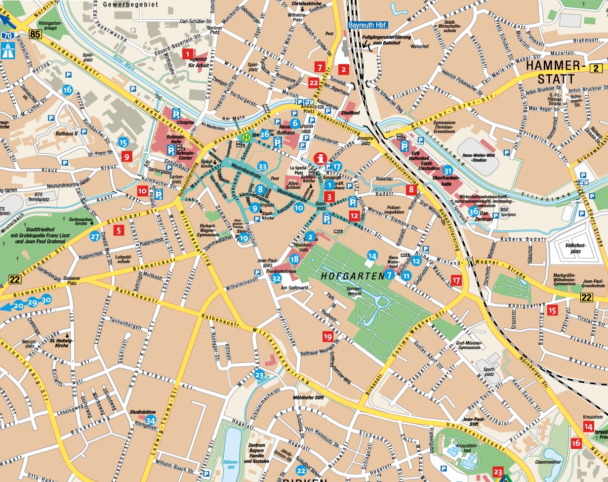
Are you planning a trip to Bayreuth and want to find your way around the town? Then the Bayreuth city map is just what you need.
The different maps
What does the Bayreuth city map include?
The Bayreuth city map shows the most important streets, sights and public facilities in the town. It is a useful tool for anyone who wants to explore the town. A printed copy of the Bayreuth city map can be picked up at our Tourist Information. Alternatively, it is also available online here.
Bayreuth city map as PDF
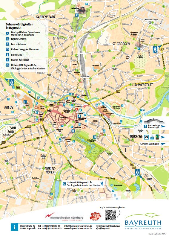
Overview map
This one-page overview map gives you a first overview of Bayreuth’s town centre.
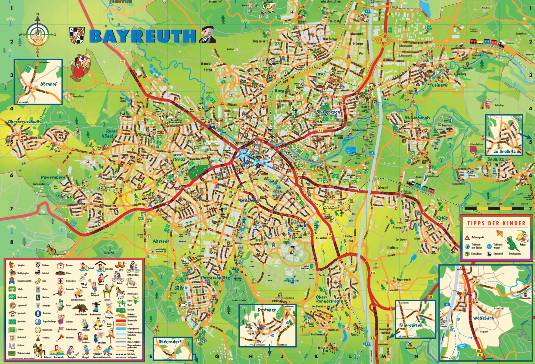
Children’s district map
The City of Bayreuth has developed this district map especially for children.
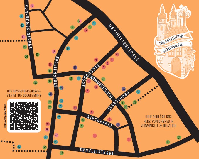
Gassenviertel map
This is where the heart of Bayreuth beats – winding and warm-hearted … immerse yourself in a wonderful quarter of diversity and inclusivity, with varied independent shops and lively bars and restaurants. Experience a meeting place for everyone who appreciates an alternative atmosphere and vibrant energy in the heart of Bayreuth.
Digital city map: Google Map
You are currently viewing a placeholder content from Google Maps. To access the actual content, click the button below. Please note that doing so will share data with third-party providers.
More InformationBus route map with sights
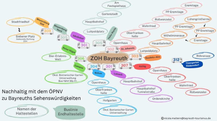
We have put together for you which bus stops to use to reach various sights in Bayreuth, so that you can leave your car behind for once. On the following page you can browse and download maps: